British Isles and UK maps
We produce a range of maps of the British Isles and UK at different sizes. Attractive, colourful and informative maps for children and detailed wall maps showing main roads, railways, ferries, counties and regions, towns and cities by population, National Parks and areas of outstanding natural beauty. There is something for everyone. Many of the maps have been designed to be fully inclusive for those with a form of colour vision deficiency (CVD). These maps of the British Isles and the UK are ideal for the office or school. Check out our fun colouring activity maps. learn the counties and create your own map.
There are already personalised versions available to buy for some maps, but if you would like any of our maps customised or personalised as a map gift please contact us.
Showing 1–20 of 40 results
-
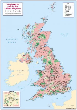
100 places to visit in the United Kingdom
Price range: £14.99 through £65.49 Select options This product has multiple variants. The options may be chosen on the product page -
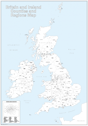
Big Britain and Ireland counties and regions colouring map
Price range: £15.99 through £39.99 Select options This product has multiple variants. The options may be chosen on the product page -
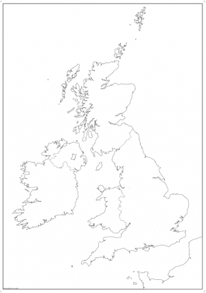
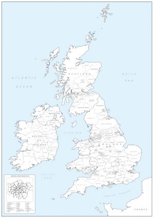
Big British Isles map outline with borders
Price range: £9.99 through £15.49 Select options This product has multiple variants. The options may be chosen on the product page -
Big personalised Britain and Ireland colouring map
Price range: £21.99 through £44.99 Select options This product has multiple variants. The options may be chosen on the product page -
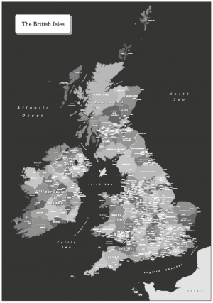
Black and white map of the British Isles
Price range: £16.99 through £65.49 Select options This product has multiple variants. The options may be chosen on the product page -
Black and White Map of the British Isles – canvas
£70.00 Select options This product has multiple variants. The options may be chosen on the product page -

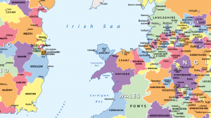
Britain and Ireland counties and regions map – small
Price range: £10.99 through £29.99 Select options This product has multiple variants. The options may be chosen on the product page -
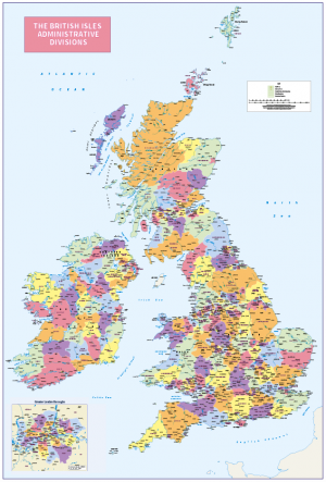
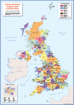
British Isles Administrative Divisions
Price range: £18.99 through £115.50 Select options This product has multiple variants. The options may be chosen on the product page -
British Isles counties colouring map
£21.99 Select options This product has multiple variants. The options may be chosen on the product page -

British Isles counties colouring map (self adhesive textile)
£22.99 Select options This product has multiple variants. The options may be chosen on the product page -
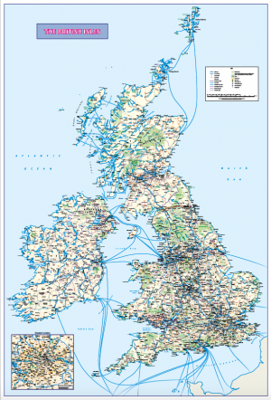
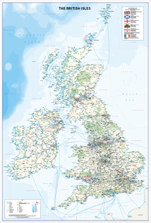
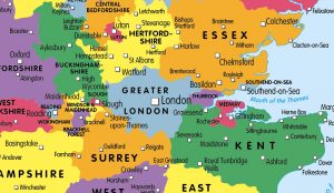
British Isles map with Greater London inset (road distance charts optional)
Price range: £18.99 through £115.50 Select options This product has multiple variants. The options may be chosen on the product page -
British Isles map with Shipping Forecast Areas
Price range: £18.99 through £115.50 Select options This product has multiple variants. The options may be chosen on the product page -
Children’s Britain and Ireland counties and regions map
Price range: £14.99 through £65.49 Select options This product has multiple variants. The options may be chosen on the product page -
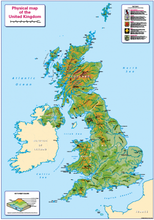
Children’s Physical Map of the United Kingdom
Price range: £14.99 through £65.49 Select options This product has multiple variants. The options may be chosen on the product page -
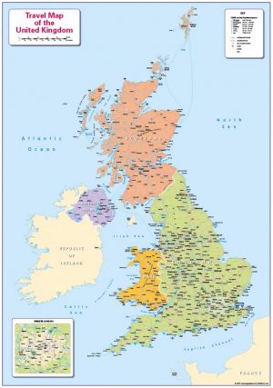
Children’s Travel map of the United Kingdom
Price range: £14.99 through £65.49 Select options This product has multiple variants. The options may be chosen on the product page -
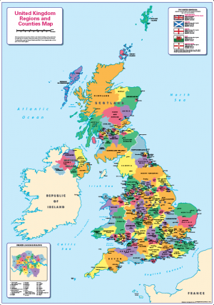
Children’s United Kingdom counties and regions map
Price range: £14.99 through £65.49 Select options This product has multiple variants. The options may be chosen on the product page -
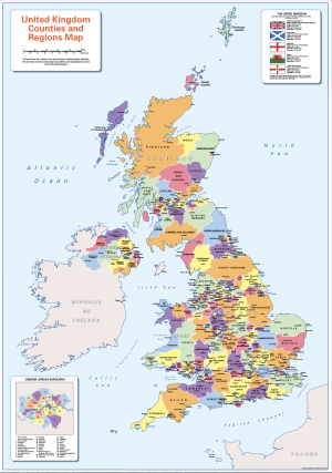
Colour blind friendly counties map of the United Kingdom
Price range: £14.99 through £65.49 Select options This product has multiple variants. The options may be chosen on the product page -
Counties and Regions of in Britain and Ireland (colour blind friendly)
Price range: £14.99 through £65.49 Select options This product has multiple variants. The options may be chosen on the product page -
Counties map of the United Kingdom – self adhesive
£19.99 Add to basket -

Counties map of the United Kingdom – small
Price range: £10.99 through £29.99 Select options This product has multiple variants. The options may be chosen on the product page