Colour blind friendly wall maps
Colour blind friendly wall maps – ideal for the school classroom or any public space. Great for school wall displays. One in twelve boys/men have a form of colour blindness. On average that is one in every classroom. A range of world maps, continental maps and maps of the British Isles including physical and political maps. All our can be printed in various sizes to suit your needs, talk to us for more options.
Showing 1–20 of 78 results
-
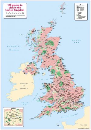
100 places to visit in the United Kingdom
Price range: £14.99 through £65.49 Select options This product has multiple variants. The options may be chosen on the product page -
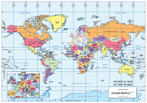
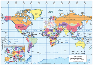
A2 World Political map – self adhesive
£18.99 Add to basket -
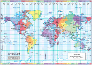
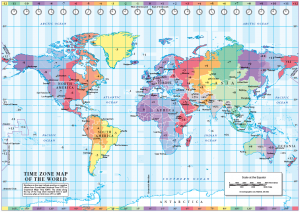
A2 World Time Zones map – self adhesive
£18.99 Add to basket -
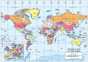
A3 Political World map – self adhesive
Price range: £14.99 through £29.99 Select options This product has multiple variants. The options may be chosen on the product page -
A3 World Time Zones map – self adhesive
Price range: £14.99 through £29.99 Select options This product has multiple variants. The options may be chosen on the product page -
A4 Political World map – self adhesive
Price range: £10.99 through £19.99 Select options This product has multiple variants. The options may be chosen on the product page -

A4 World Time Zones map – self adhesive
Price range: £10.99 through £19.99 Select options This product has multiple variants. The options may be chosen on the product page -
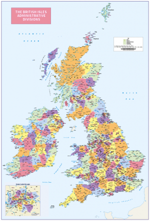
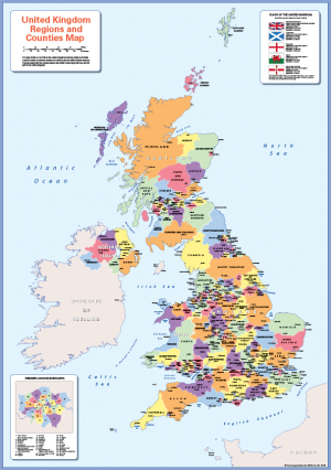
British Isles Administrative Divisions
Price range: £18.99 through £115.50 Select options This product has multiple variants. The options may be chosen on the product page -
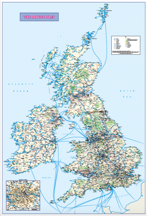
British Isles map with Greater London inset (road distance charts optional)
Price range: £18.99 through £115.50 Select options This product has multiple variants. The options may be chosen on the product page -
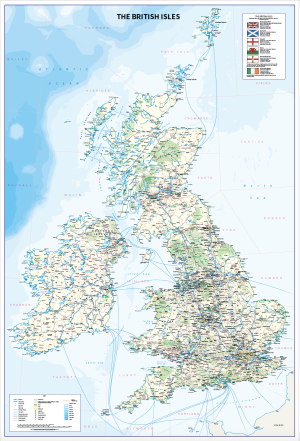
British Isles map with Shipping Forecast Areas
Price range: £18.99 through £115.50 Select options This product has multiple variants. The options may be chosen on the product page -
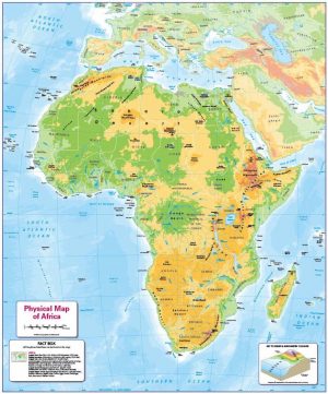
Children’s Physical map of Africa
Price range: £14.99 through £65.49 Select options This product has multiple variants. The options may be chosen on the product page -
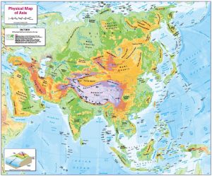
Children’s Physical map of Asia
Price range: £14.99 through £65.49 Select options This product has multiple variants. The options may be chosen on the product page -
Children’s Physical map of Asia- small map
Price range: £7.99 through £29.99 Select options This product has multiple variants. The options may be chosen on the product page -
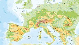
Children’s Physical map of Europe
Price range: £14.99 through £65.49 Select options This product has multiple variants. The options may be chosen on the product page -
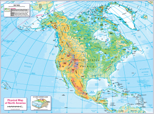
Children’s physical map of North America
Price range: £14.99 through £65.49 Select options This product has multiple variants. The options may be chosen on the product page -
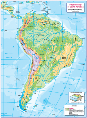
Children’s physical map of South America
Price range: £14.99 through £65.49 Select options This product has multiple variants. The options may be chosen on the product page -
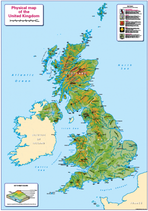
Children’s Physical Map of the United Kingdom
Price range: £14.99 through £65.49 Select options This product has multiple variants. The options may be chosen on the product page -
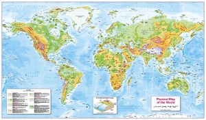
Children’s Physical map of the World
Price range: £14.99 through £65.49 Select options This product has multiple variants. The options may be chosen on the product page -
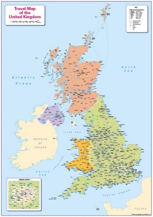
Children’s Travel map of the United Kingdom
Price range: £14.99 through £65.49 Select options This product has multiple variants. The options may be chosen on the product page -
Colour blind friendly counties map of the United Kingdom
Price range: £14.99 through £65.49 Select options This product has multiple variants. The options may be chosen on the product page