Children's illustrated maps
Colourful, fun and informative illustrated maps taken from Collins Children’s Picture atlas. Printed on a quality, heavy satin paper or canvas, perfect for framing or mounting.
There are already personalised versions available to buy for some maps, but if you would like any of these illustrated maps personalised as a map gift please contact us.
Showing 1–20 of 32 results
-

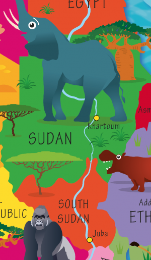
Children’s Africa Picture Map
Price range: £16.99 through £58.98 Select options This product has multiple variants. The options may be chosen on the product page -

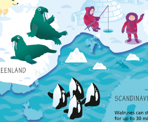
Children’s Arctic and Antarctic Picture Map
Price range: £16.99 through £58.98 Select options This product has multiple variants. The options may be chosen on the product page -

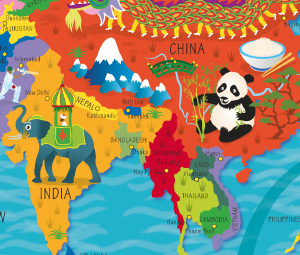
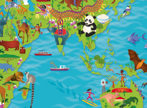
Children’s Asia Picture Map
Price range: £16.99 through £58.98 Select options This product has multiple variants. The options may be chosen on the product page -
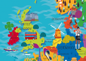
Children’s Europe Picture Map
Price range: £16.99 through £58.98 Select options This product has multiple variants. The options may be chosen on the product page -

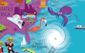
Children’s North America Picture Map
Price range: £16.99 through £58.98 Select options This product has multiple variants. The options may be chosen on the product page -
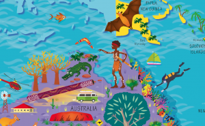
Children’s Oceania Picture Map
Price range: £16.99 through £58.98 Select options This product has multiple variants. The options may be chosen on the product page -
Children’s Picture Africa Map – Large
Price range: £23.99 through £81.49 Select options This product has multiple variants. The options may be chosen on the product page -
Children’s Picture Arctic and Antarctic Map – Large
Price range: £23.99 through £81.49 Select options This product has multiple variants. The options may be chosen on the product page -
Children’s Picture Asia Map – Large
Price range: £23.99 through £81.49 Select options This product has multiple variants. The options may be chosen on the product page -

Children’s Picture Europe Map – Large
Price range: £23.99 through £81.49 Select options This product has multiple variants. The options may be chosen on the product page -
Children’s Picture North America Map – Large
Price range: £23.99 through £81.49 Select options This product has multiple variants. The options may be chosen on the product page -

Children’s Picture Oceania Map – Large
Price range: £23.99 through £81.49 Select options This product has multiple variants. The options may be chosen on the product page -

Children’s Picture South America Map – Large
Price range: £23.99 through £74.99 Select options This product has multiple variants. The options may be chosen on the product page -
Children’s Picture World Countries Map – Framed canvas
£65.00 Select options This product has multiple variants. The options may be chosen on the product page -
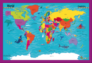
Children’s Picture World Countries Map – Large
Price range: £23.99 through £81.49 Select options This product has multiple variants. The options may be chosen on the product page -

Children’s Picture World Countries Map – Large Framed canvas
£105.00 Select options This product has multiple variants. The options may be chosen on the product page -
Children’s Picture World Map – Framed canvas
£65.00 Select options This product has multiple variants. The options may be chosen on the product page -
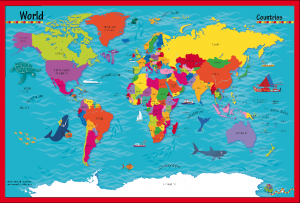
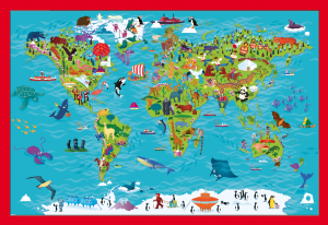
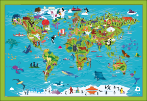
Children’s Picture World Map – Large
Price range: £23.99 through £81.49 Select options This product has multiple variants. The options may be chosen on the product page -
Children’s Picture World Map – Large Framed canvas
£105.00 Select options This product has multiple variants. The options may be chosen on the product page -
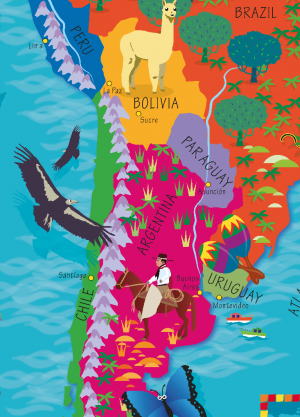
Children’s South America Picture Map
Price range: £16.99 through £58.98 Select options This product has multiple variants. The options may be chosen on the product page