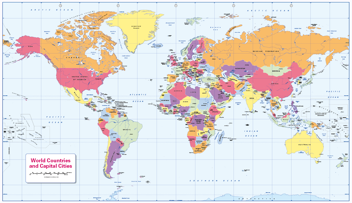
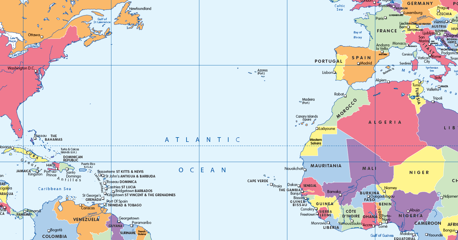
World Countries and Capital Cities (colour blind friendly)
£14.99 – £65.49
Description
Description
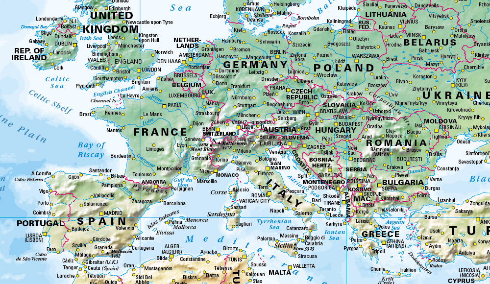
Learn and teach world countries and their capital cities with our colourful, easy to read children’s map. also includes major rivers and lakes and the International date-line. This colour blind friendly map is ideal for the home or classroom where there is likely to be at least one child in every classroom that has a form of colour blindness. Our colours work for everyone, but the map is designed especially to work with any form of colour vision deficiency (CVD). Contact us for encapsulated or framed canvas prints.
Scale 1:40 million; size 1020 x 595mm.
Additional information
Additional information
| Weight | 6 kg |
|---|---|
| Please Select | Canvas (rolled), Laminated and mounted on 5mm Foam-X board, Laminated and mounted on 5mm Foam-X board with wall hangers, Laminated print (with free stickers), Matt paper, Satin photo paper |
| Lamination (if laminated print is chosen) | Gloss, Matt, None |
Reviews (0)
Related products
-
World Map decor – green and yellow
£14.99 – £65.49 Select options This product has multiple variants. The options may be chosen on the product page -
World Map decor – red, orange and yellow (large)
£17.99 – £125.50 Select options This product has multiple variants. The options may be chosen on the product page -
World map – natural colours
£14.99 – £65.49 Select options This product has multiple variants. The options may be chosen on the product page -
Big world colouring map -self adhesive
£21.99 Select options This product has multiple variants. The options may be chosen on the product page
Reviews
There are no reviews yet.