Sale!


The British Isles by Train and Ferry map and Road map of England and Wales in the Late Middle Ages c.1450 – 1500 (folded maps)
Original price was: £28.49.£23.00Current price is: £23.00.
82 in stock
Description
Description
Buy together and get a great deal on these two maps, for a limited time only.
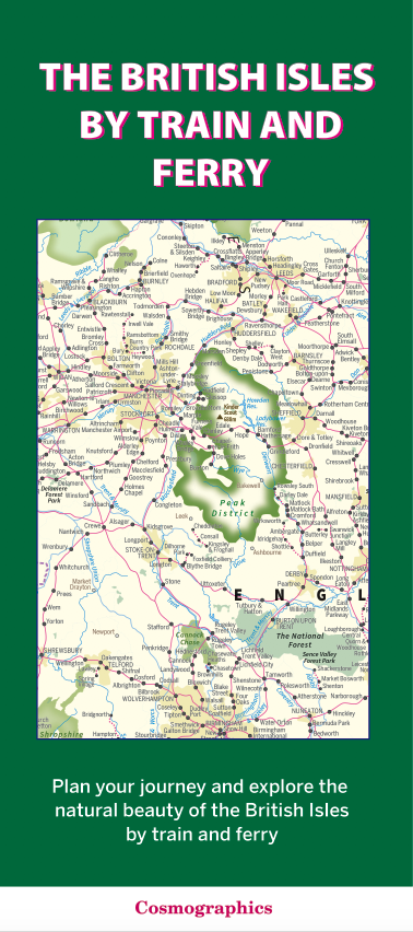
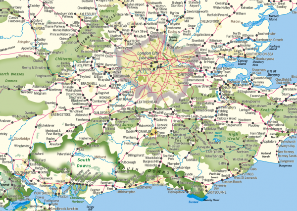
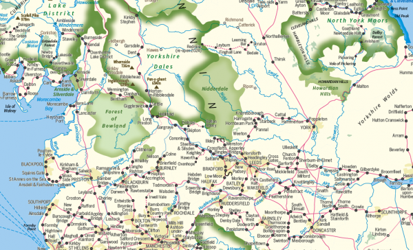
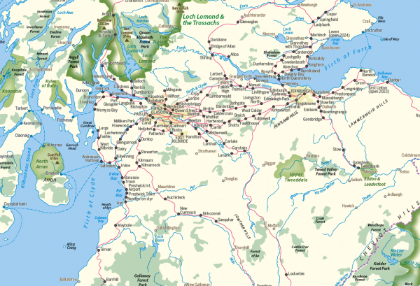
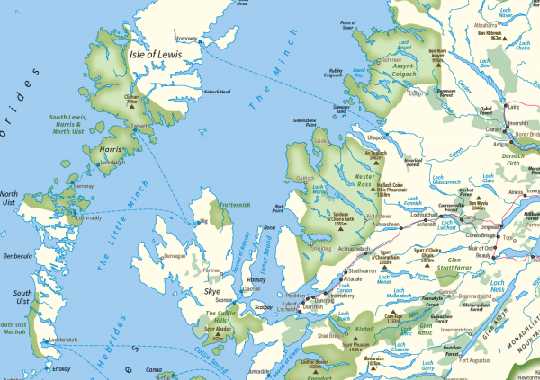
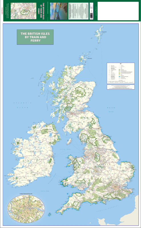
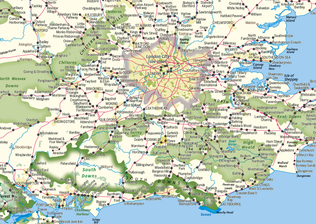
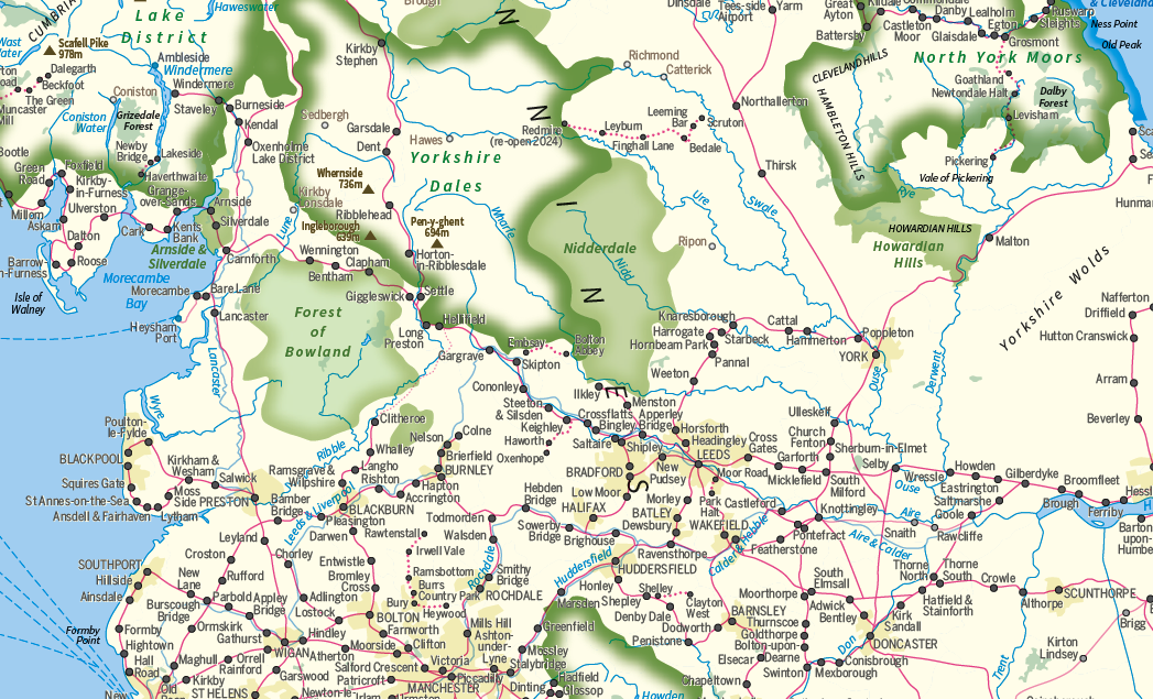
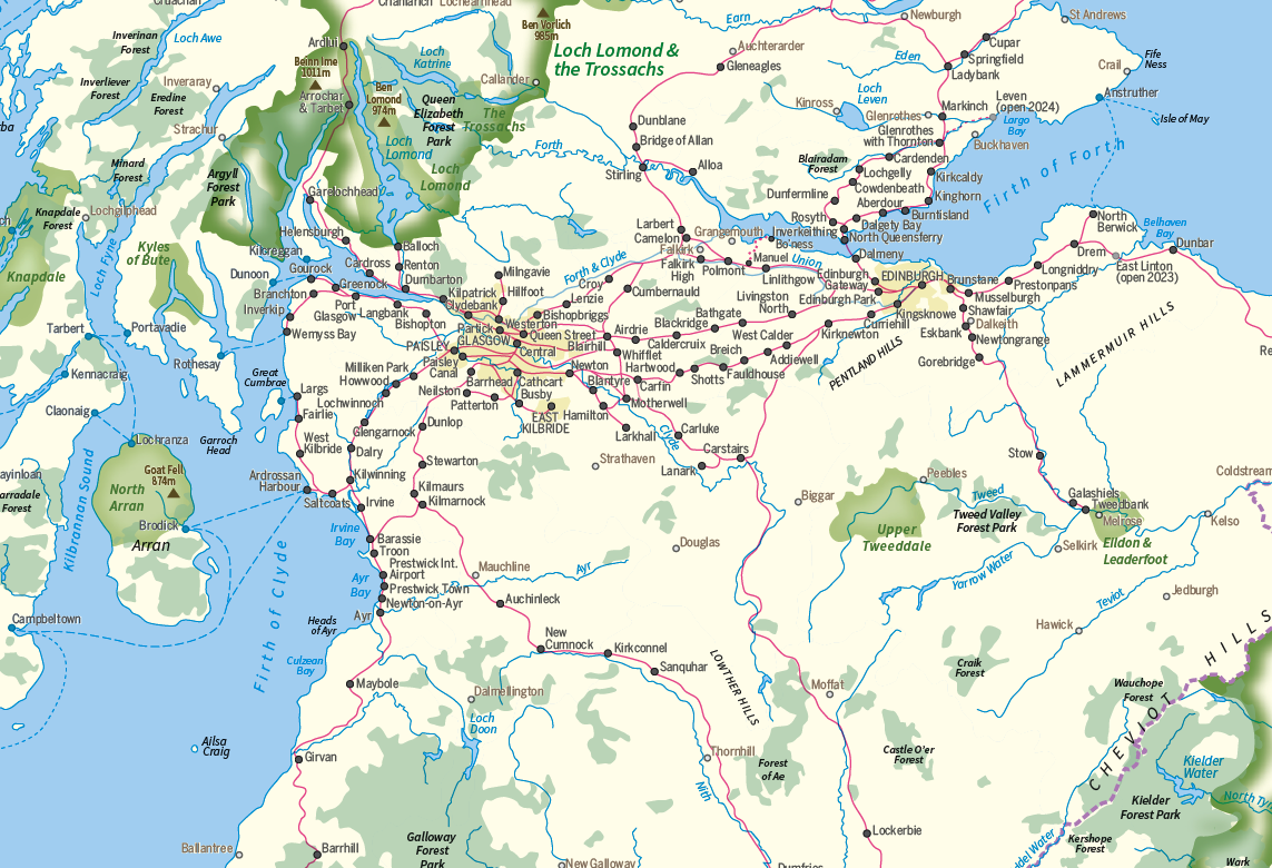
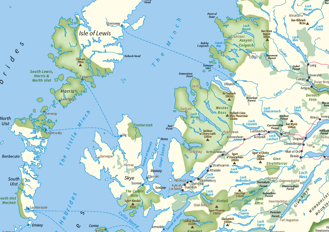
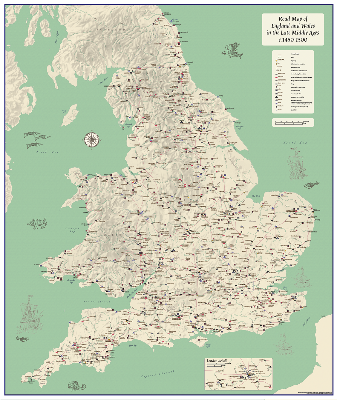
The British Isles by Train and Ferry map.
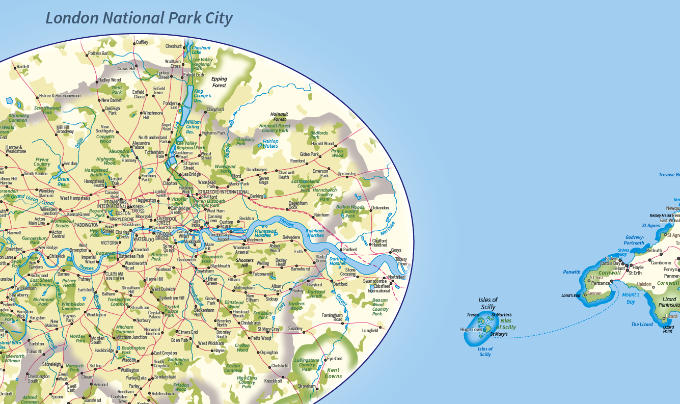
Plan your journey and explore the British Isles by train and ferry. This attractive, detailed folded map shows how the rail network, along with ferries to the more isolated areas, allows you to travel to places right across the British Isles and take in the beautiful scenery. The British Isles by train and ferry map clearly shows National Parks, Areas of Outstanding Natural Beauty, forest and woodland areas and the Heritage Coast in England and Wales, much of which is accessible by train and ferry. The railway network shown includes seasonal and heritage railways. There is also a more detailed map of the London National Park City, the world’s first National Park City.
The British Isles by Train and Ferry map is designed to be fully inclusive and accessible for everyone, including those with colour vision deficiency (CVD).
Map includes:
Passenger rail network with the majority of stations.
Seasonal and heritage railways
Ferry routes
National Parks
Areas of Outstanding Natural Beauty
Main forest and woodland areas
Heritage coast in England and Wales
Scale: 1; 1,250,000. Folded size: 110mm x 250mm Sheet size 745mm x 1210mm
ISBN: 978 0957447 226
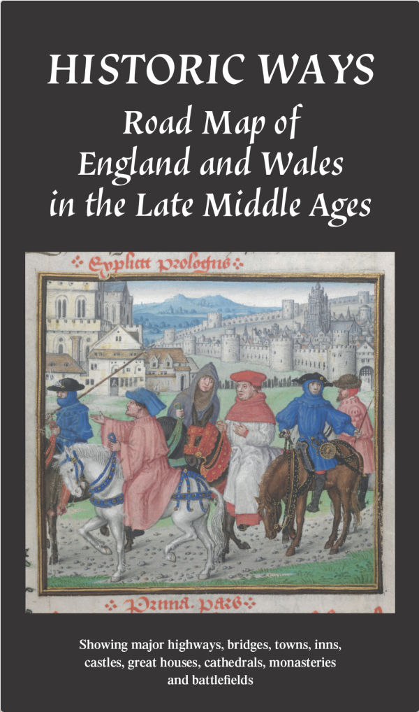
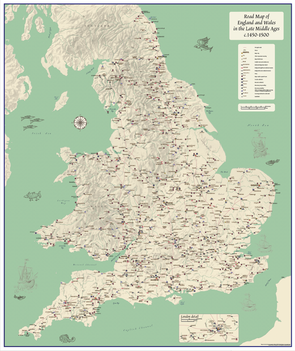
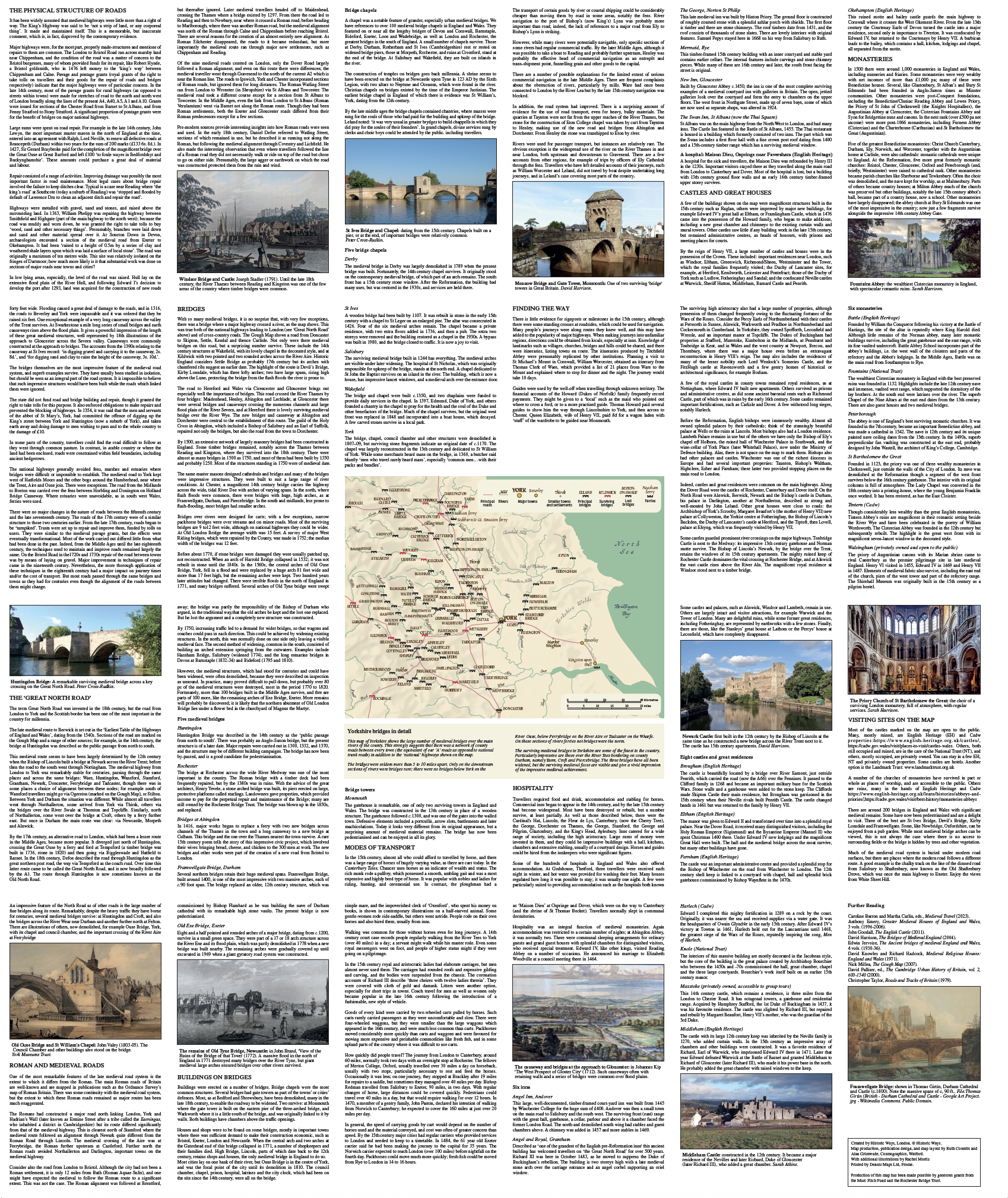
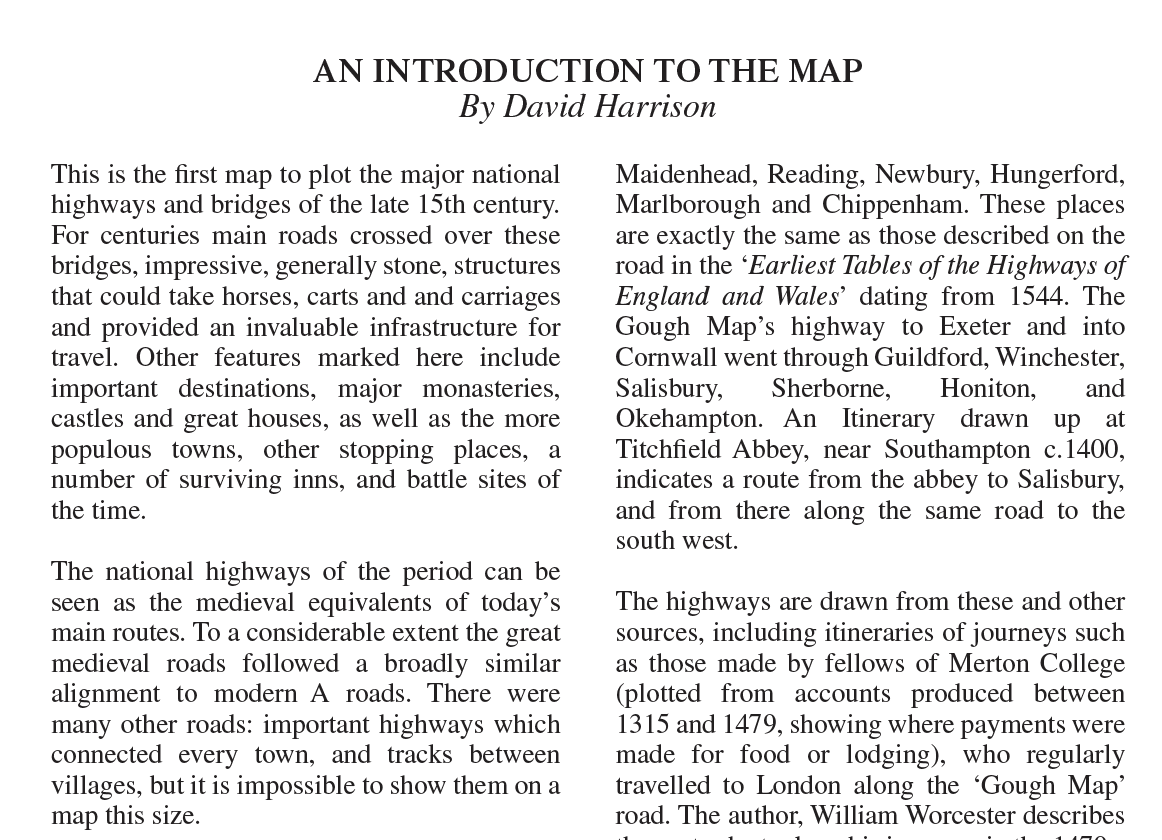
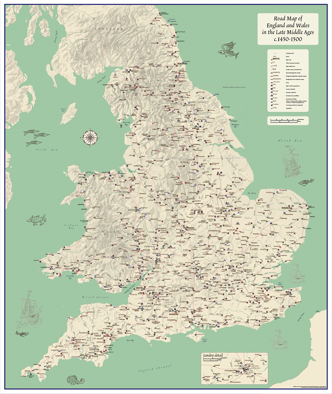
Road map of England and Wales in the Late Middle Ages c.1450 – 1500.
A double sided, folded map. The front includes an informative road map of England and Wales in the Late Middle Ages in an attractive design. The main map inspired by the Gough map shows the main roads used to travel in England and Wales c.1450 – 1500 with easy to read, clear symbology. A must for lovers of medieval history and historians. Explore the Middle Ages in your home or office and plan your next journey and visit locations.
Map includes:
* Major Highways
* Bridges
* Towns
* Castles
* Great Houses
* Monasteries
* Cathedrals
* Inns
* Battlefields
Scale 1: 800,000
The reverse side is a mix of meticulously researched information, photographs and pictures of a selection of locations and an enlarged map of the Yorkshire area.
Perfect for any enthusiast, be it at home, in the classroom or office. Developed by the Publisher Historic Ways (Author – David Harrison), this has been a lifetimes work.
Folded map size (not cover size) 125mm x 222.5mm
Flat sheet size 750mm x 890mm.
Additional information
Additional information
| Weight | .1 kg |
|---|
Reviews (0)
Related products
-
Large personalised Britain and Ireland counties colouring map
Price range: £25.99 through £73.99 Select options This product has multiple variants. The options may be chosen on the product page -
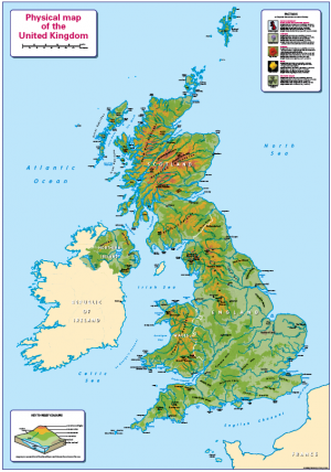
Children’s Physical Map of the United Kingdom
Price range: £14.99 through £65.49 Select options This product has multiple variants. The options may be chosen on the product page -
Britain and Ireland counties and regions map – small
Price range: £10.99 through £29.99 Select options This product has multiple variants. The options may be chosen on the product page -
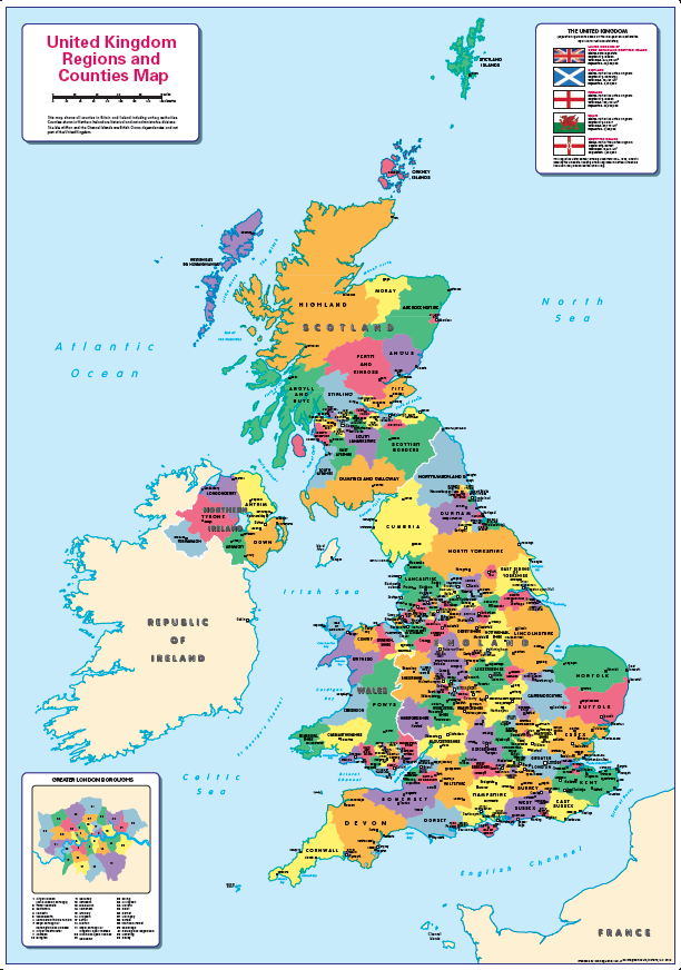
United Kingdom counties and regions map – small
Price range: £10.99 through £29.55 Select options This product has multiple variants. The options may be chosen on the product page
Reviews
There are no reviews yet.