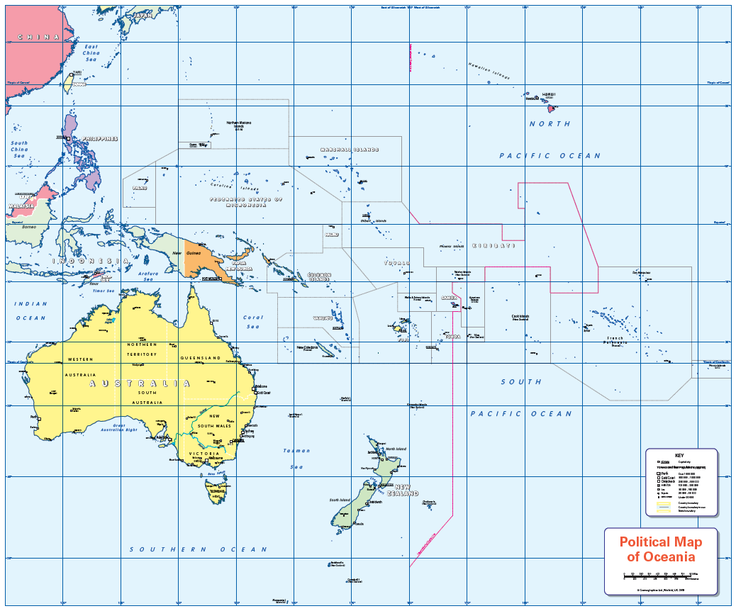
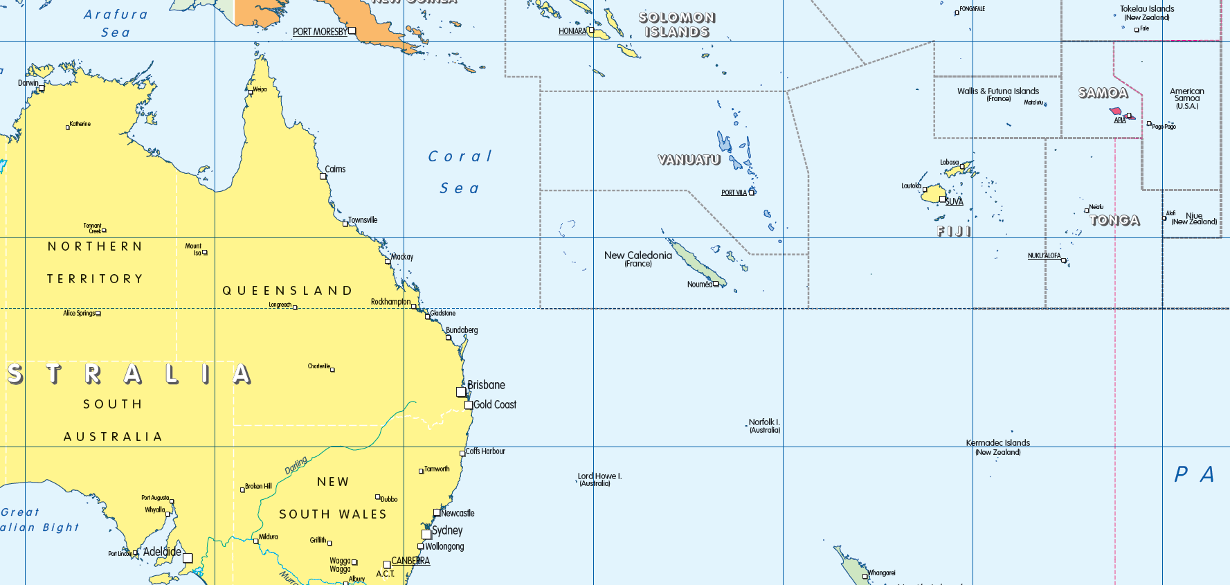
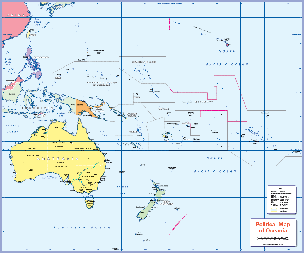
Political map of Oceania
Price range: £29.98 through £70.49
Description
Description
There is likely to be at least one child in every classroom that is colour blind. Designed especially to work with any form of colour blindness, this colourful, easy to read children’s map of Oceania showing countries, states, capitals and a selection of cities and main towns is ideal for the home, office or classroom. Contact us for encapsulated or framed canvas prints. A pack of FREE stickers is included when you purchase a laminated print (96 stickers in 12 different colours).
Size 805 x 668mm
Additional information
Additional information
| Weight | 6 kg |
|---|---|
| Please Select | Canvas (rolled), Laminated and mounted on 5mm Foam-X board, Laminated print, Matt paper, Satin photo paper |
| Choose colour of map surround | Purple, White |
| Lamination (if laminated print is chosen) | Gloss, Matt, None |
Reviews
There are no reviews yet.