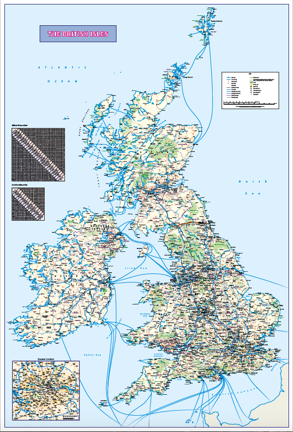
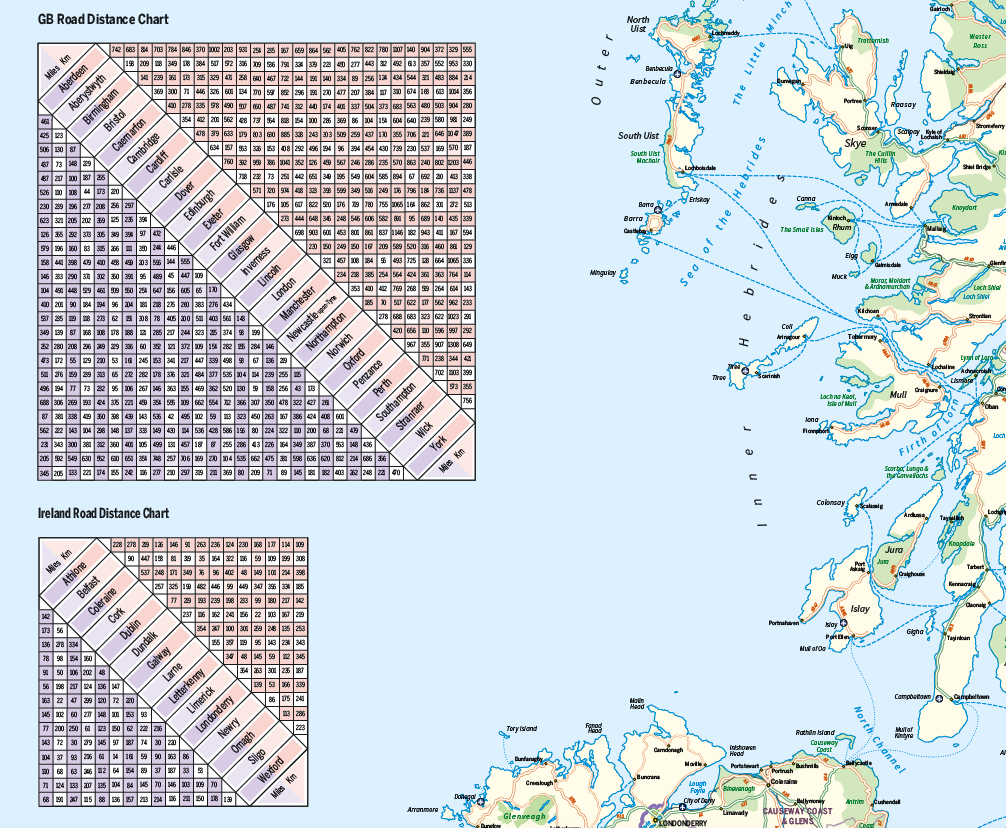
Personalised British Isles map with Greater London inset (road distance charts optional)
£30.99 – £127.50
Description
Description
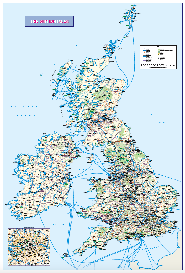
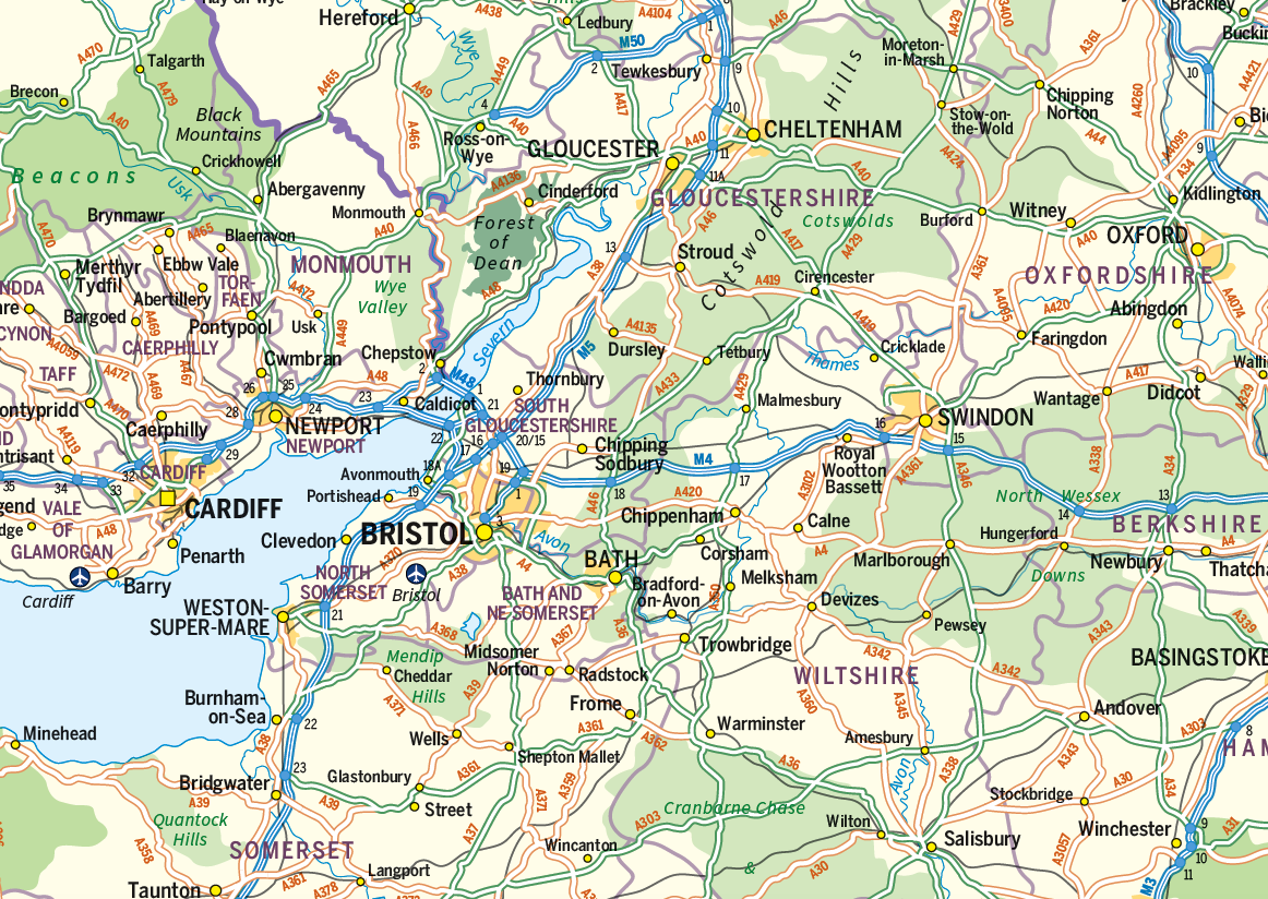
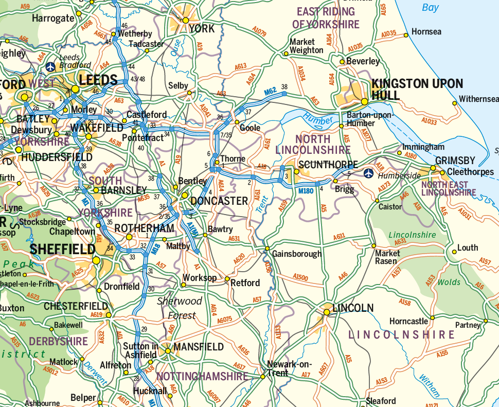
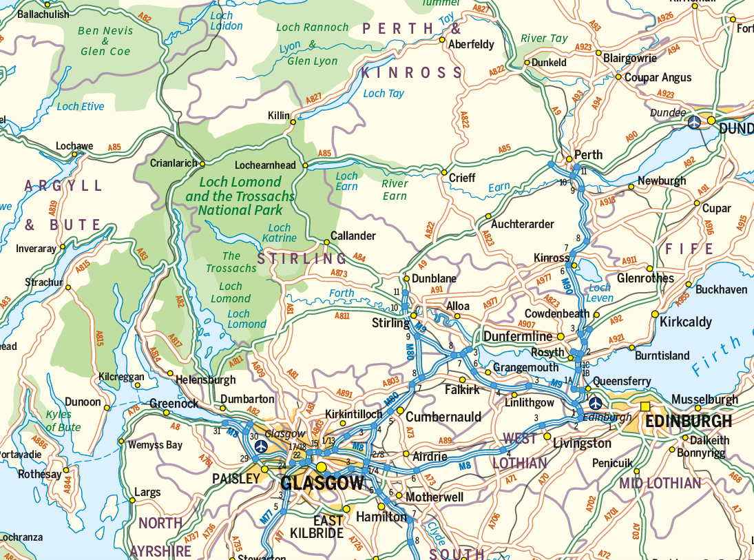
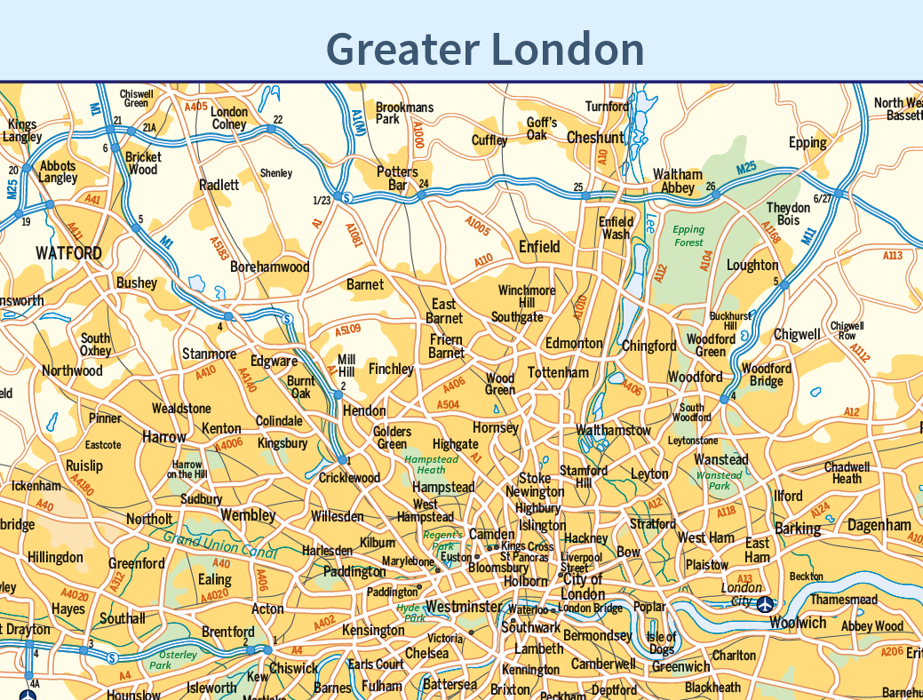
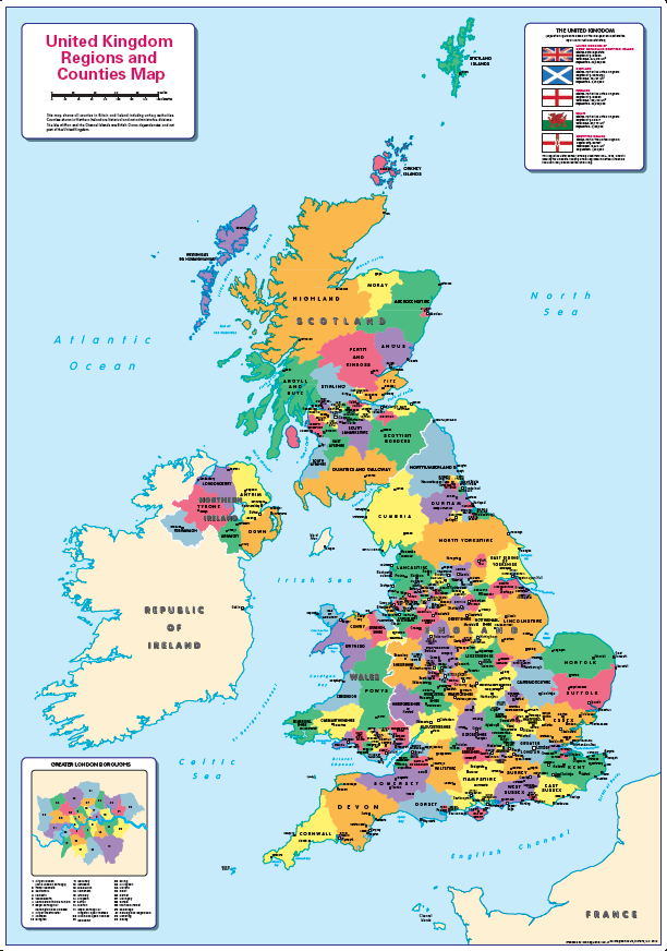
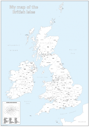
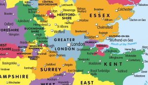
Personalise this informative and attractive map of the British Isles showing main roads, railways, ferries , counties, towns and cities by population, National Parks and Areas of Outstanding Natural Beauty. Send us your company logo and details to make this map your own. There is also the option to include a road distance charts for the UK and Ireland on your print. Ideal as a corporate gift, or as a planning tool for the office or home. Designed to be fully inclusive and designed to work for everyone, including those with colour vision deficiency (CVD).
Options are available for paper, laminated, canvas and mounted prints. Contact us for different sizes, encapsulated or framed canvas prints or if you have any other questions.
Size 745mm x 1100mm Scale 1:1,250,000
Additional information
Additional information
| Weight | 9.75 kg |
|---|---|
| Please Select | Canvas (rolled), Gloss laminated (with free stickers), Laminated and mounted on 5mm Foam-X board, Laminated and mounted on 5mm Foam-X board with wall hangers, Matt laminated (with free stickers), Matt paper, Satin photo paper |
| Choose version | With road distance chart, Without road distance chart |
Reviews (0)
Related products
-
Big Britain and Ireland counties and regions colouring map
£15.99 – £39.99 Select options This product has multiple variants. The options may be chosen on the product page -
United Kingdom counties and regions map – small
£10.99 – £29.55 Select options This product has multiple variants. The options may be chosen on the product page -
Big personalised Britain and Ireland colouring map
£21.99 – £44.99 Select options This product has multiple variants. The options may be chosen on the product page -
Britain and Ireland counties and regions map – small
£10.99 – £29.99 Select options This product has multiple variants. The options may be chosen on the product page
Reviews
There are no reviews yet.