
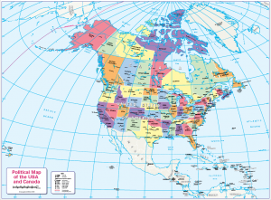
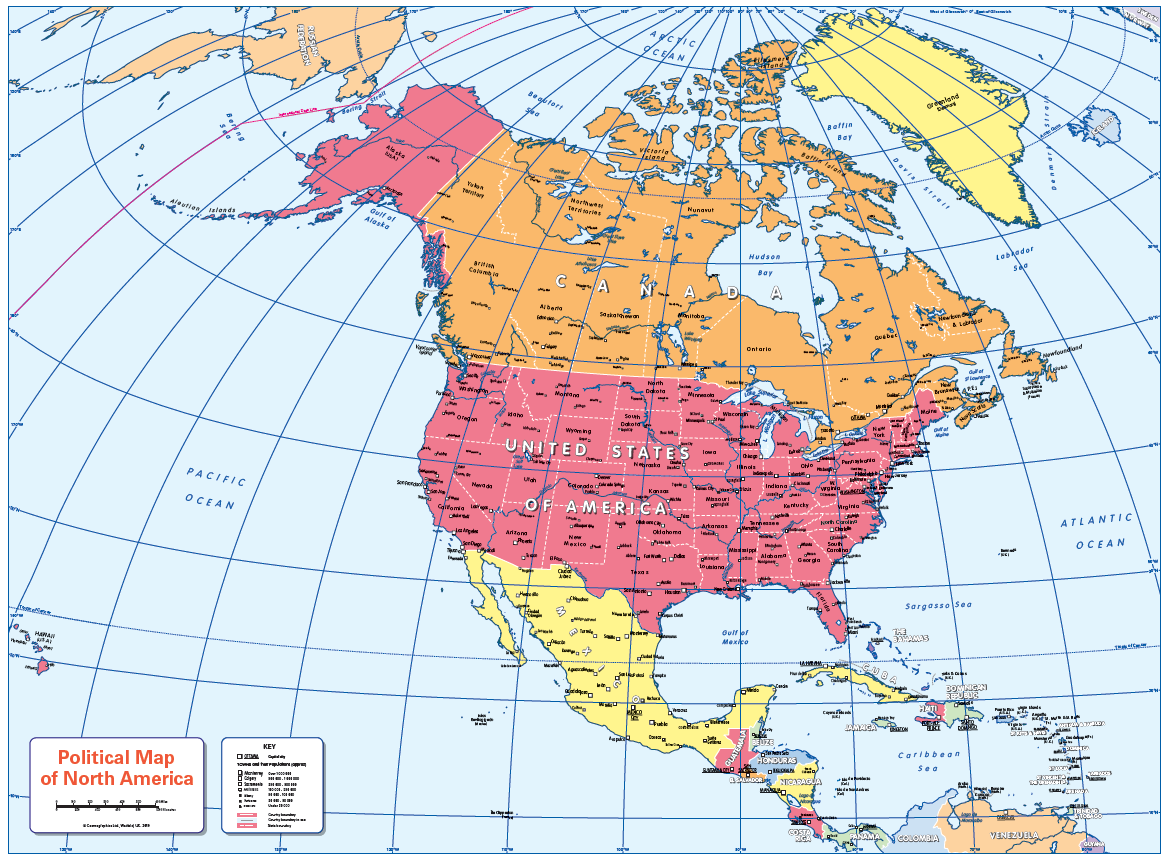
Children’s political map of North America
Price range: £14.99 through £65.49
Description
Description
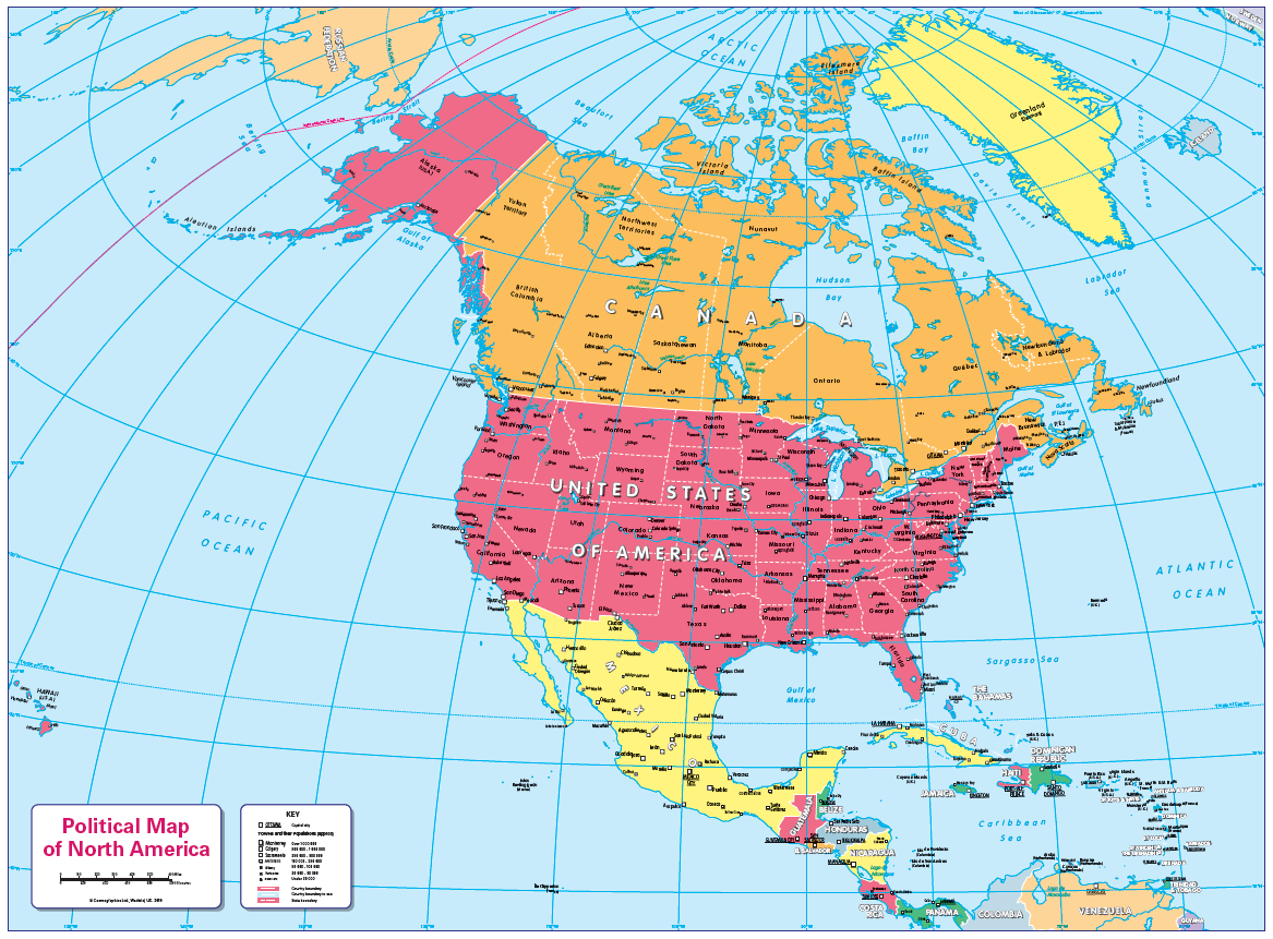
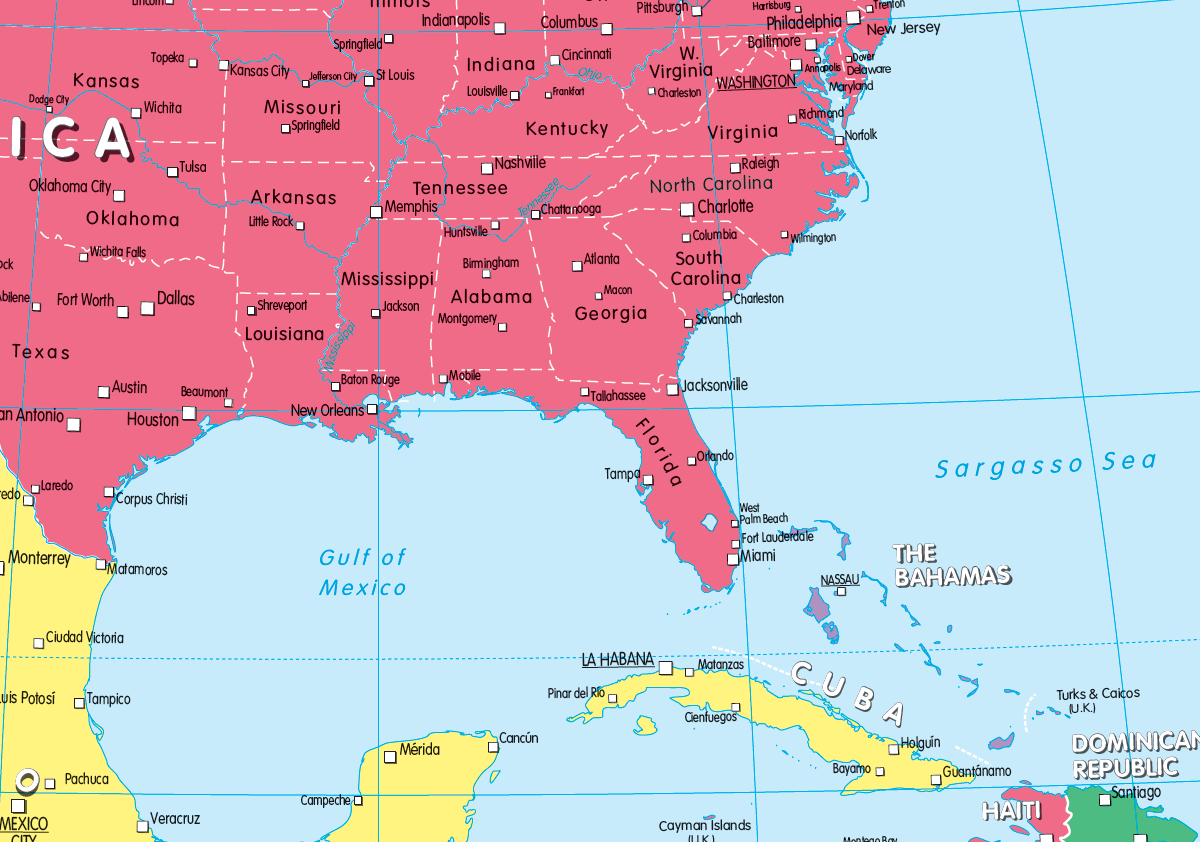
A colourful, easy to read children’s map of North America showing countries, states, capitals and a selection of cities and main towns. Ideal for the home or school classroom. Contact us for encapsulated or framed canvas prints.
Size 905 x 668mm
Additional information
Additional information
| Weight | 6 kg |
|---|---|
| Please Select | Canvas (rolled), Laminated and mounted on 5mm Foam-X board, Laminated and mounted on 5mm Foam-X board with wall hangers, Laminated print, Matt paper, Satin photo paper |
| Lamination (if laminated print is chosen) | Gloss, Matt, None |
Reviews (0)
Related products
-
Large personalised North America colouring map
Price range: £25.99 through £73.99 Select options This product has multiple variants. The options may be chosen on the product page -
Large North America colouring map
Price range: £19.99 through £66.99 Select options This product has multiple variants. The options may be chosen on the product page -
Colour blind friendly map of Canada and the USA
Price range: £14.99 through £65.49 Select options This product has multiple variants. The options may be chosen on the product page -
Political map of North America – small wall map
Price range: £7.99 through £29.99 Select options This product has multiple variants. The options may be chosen on the product page
Reviews
There are no reviews yet.