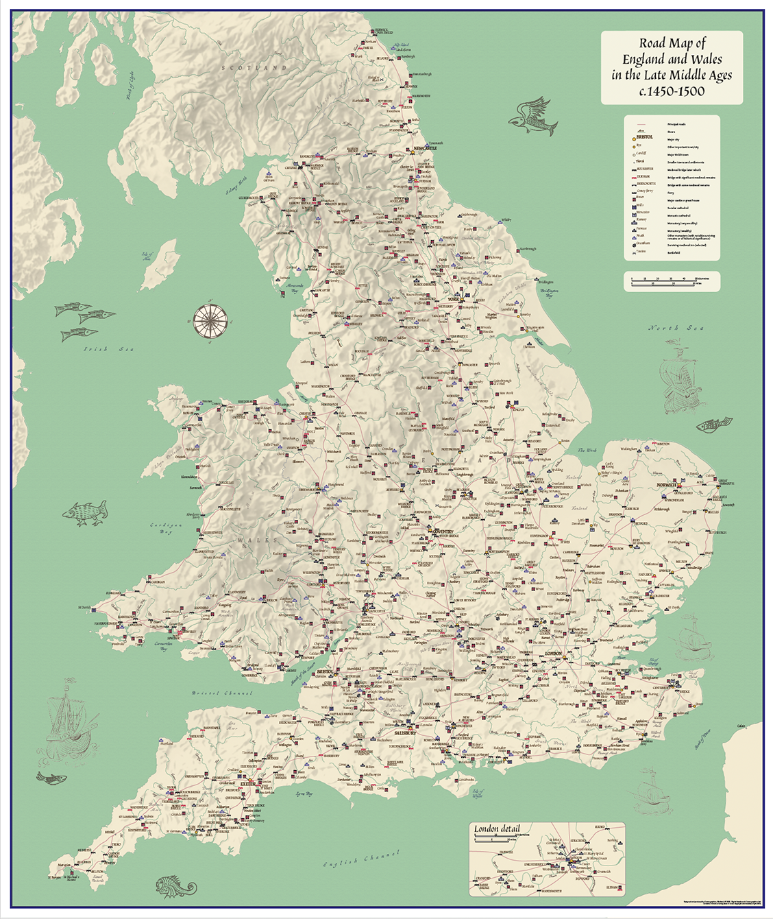

Road map of England and Wales in the Late Middle Ages c.1450 – 1500 (wall map)
Price range: £24.99 through £80.49
Description
Description
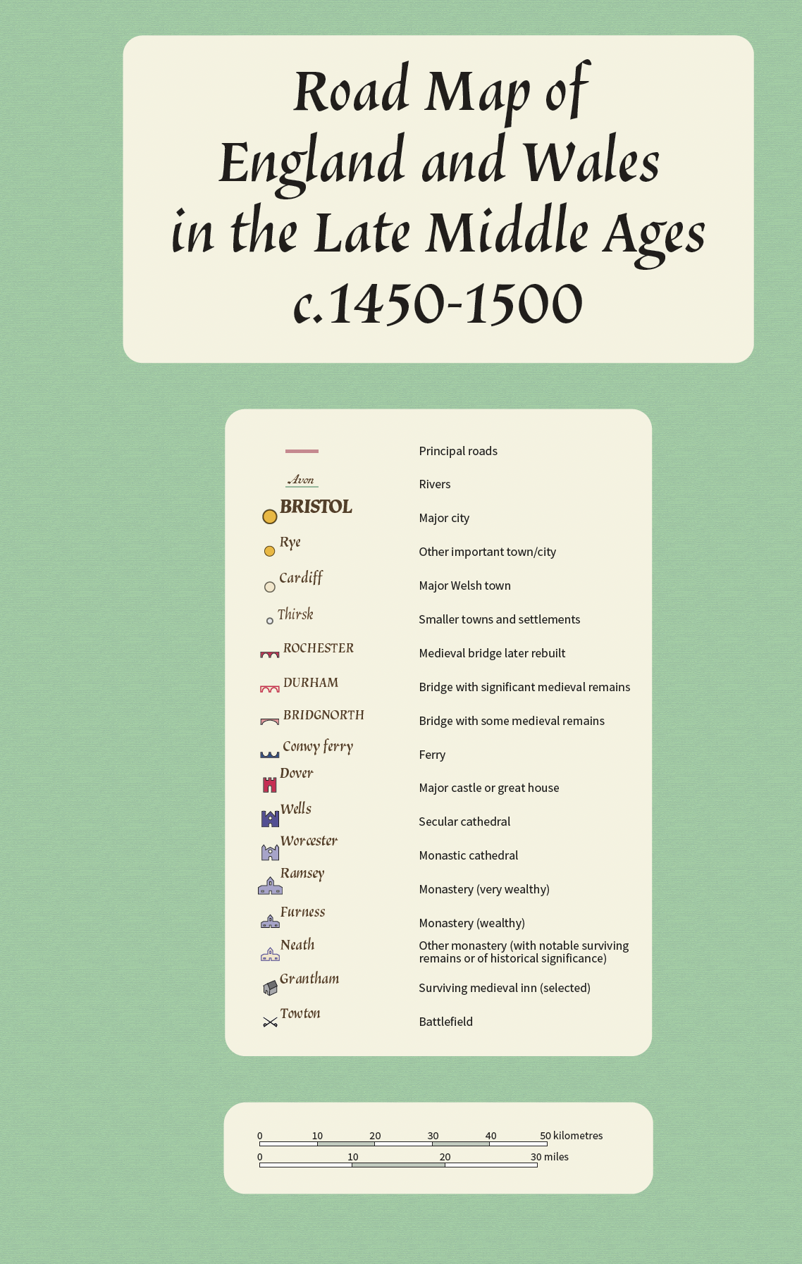
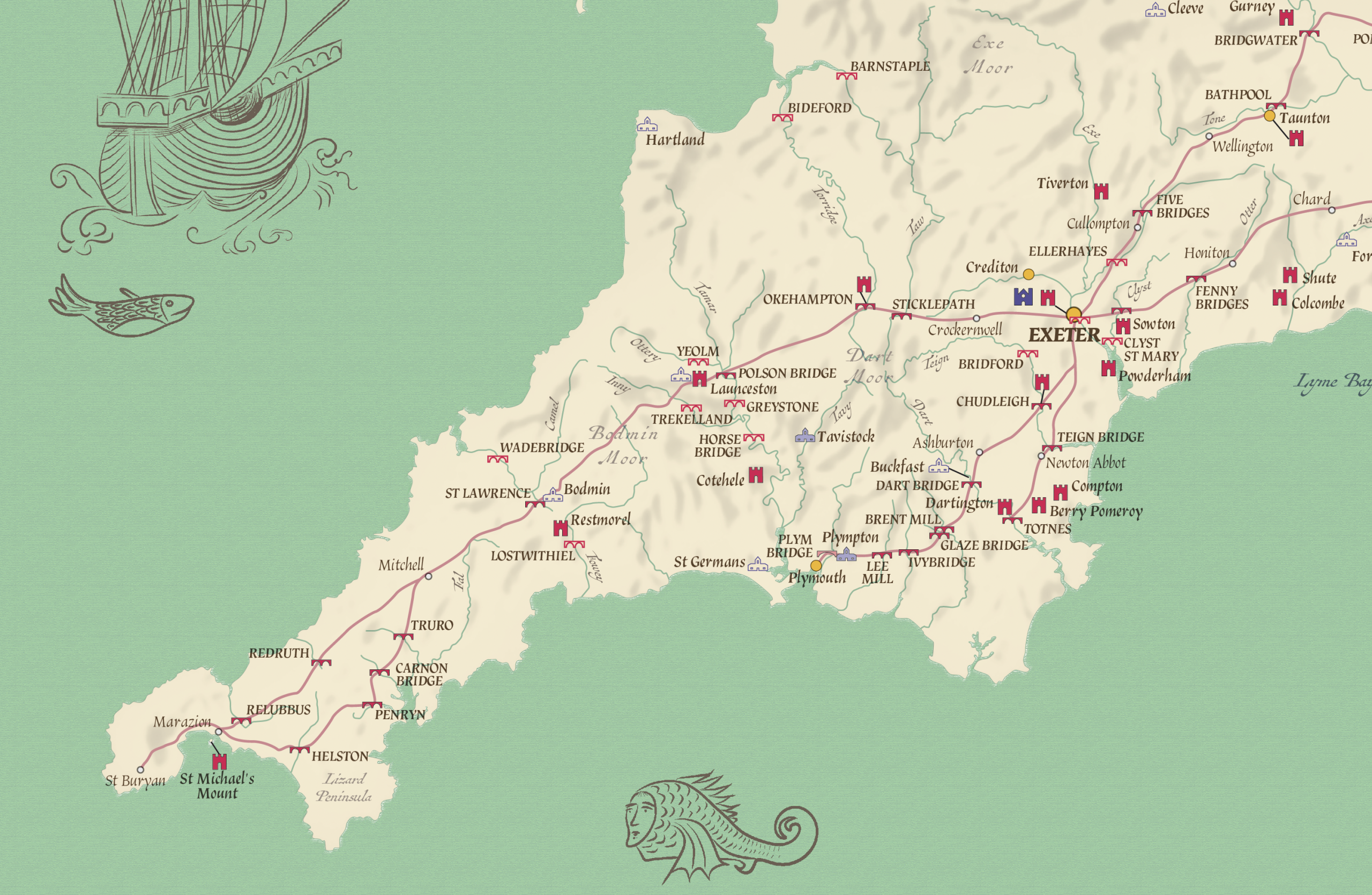
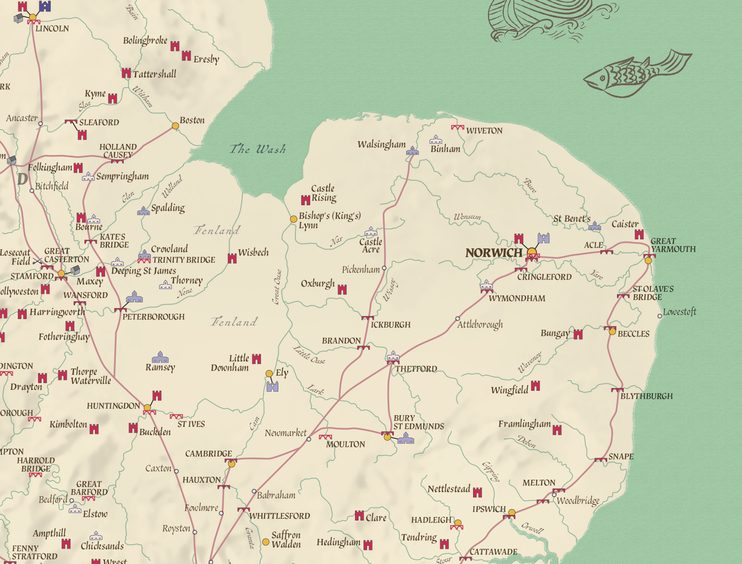
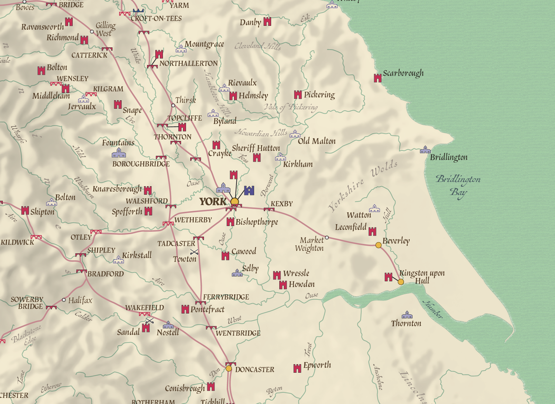
An attractive, informative Road map of England and Wales in the Late Middle Ages the design was inspired by the Gough map. Easy to read with clear symbology, the map shows main roads used to travel in England and Wales c.1450 – 1500.
Map includes:
* Major Highways
* Bridges
* Towns
* Castles
* Great Houses
* Monasteries
* Cathedrals
* Inns
* Battlefields
The map was developed by the Publisher Historic Ways (David Harrison) and has been a lifetimes work.
A must for lovers of medieval history and historians. Explore the Middle Ages in your home or office and plan your next journey and visit locations.
Would be perfect for any enthusiast, be it at home, in the classroom or office.
Scale 1: 800,000
Print options available include two different paper types (matt and satin gloss), laminated (matt or gloss), canvas (rolled) and mounted prints.
Size 890mm x 750mm. Contact us for different sizes or framed canvas prints.
Also available as a double sided folded map with lots of carefully researched information, photographs and an enlarged map of the Yorkshire area.
Additional information
Additional information
| Weight | N/A |
|---|---|
| Please Select | Canvas (rolled), Gloss laminated, Laminated and mounted on 5mm Foam-X board, Laminated and mounted on 5mm Foam-X board with wall hangers, Matt laminated, Matt paper, Satin photo paper |
Reviews (0)
Related products
-
Counties map of the United Kingdom – small
Price range: £10.99 through £29.99 Select options This product has multiple variants. The options may be chosen on the product page -
British Isles counties colouring map (self adhesive textile)
£22.99 Select options This product has multiple variants. The options may be chosen on the product page -
United Kingdom counties and regions map – small
Price range: £10.99 through £29.55 Select options This product has multiple variants. The options may be chosen on the product page -
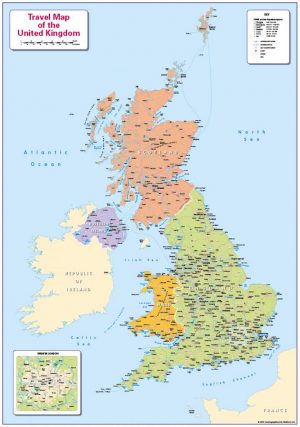
Children’s Travel map of the United Kingdom
Price range: £14.99 through £65.49 Select options This product has multiple variants. The options may be chosen on the product page
Reviews
There are no reviews yet.